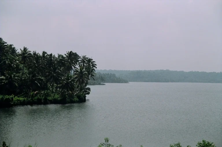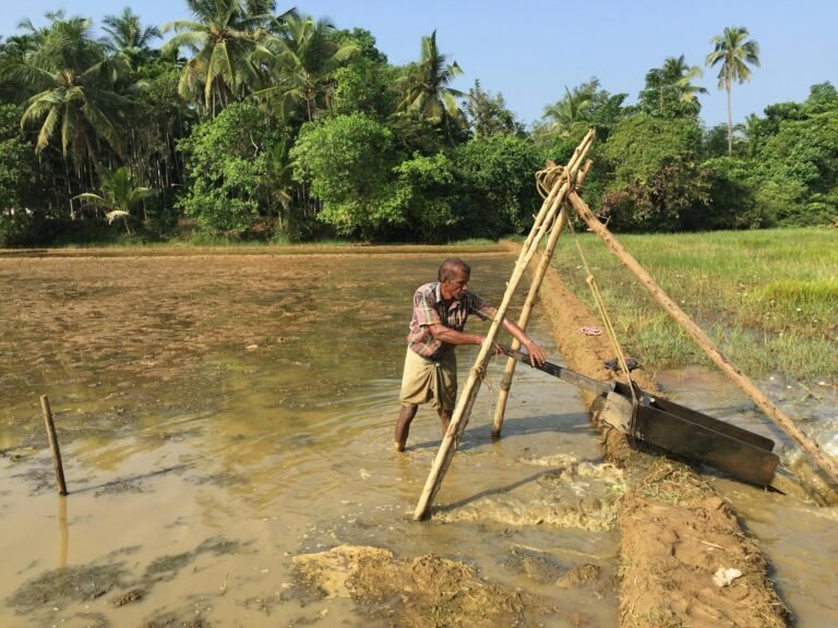
Centuries?old, community?run canals deliver affordable, equitable irrigation in a region where rainfall rushes off the slopes and only 29% of farmland is irrigated.
When rivers run low and pumps are out of reach, farmers in Bodoland turn to an old ally: the Dong. This community?run network of earthen canals, fed by hill streams from Bhutan and Arunachal Pradesh, has sustained wet paddy and village life for generations.
In a region where only about 29% of farmland is irrigated – despite over 2000 mm of annual rainfall lost to fast run?off on sloping terrain – the Dong system remains a cost?effective, reliable, and equitable lifeline.
For the uninitiated, Dong irrigation is a community?managed method that diverts river water through earthen canals for irrigation and household use. Built and maintained by villagers using locally available materials, it keeps fields productive through dry seasons, especially near the Indo?Bhutan border where natural water bodies and groundwater are limited. Its strength lies in collective management, low cost, and sustainable use of the water resource base—qualities that matter even more today with erratic monsoons and flood damage stressing modern infrastructure.
Situated on the north bank of the Brahmaputra below the foothills of Bhutan and Arunachal Pradesh, Bodoland – comprising Kokrajhar, Baksa, Udalguri, Chirang, and Tamulpur – slopes gently from the plains in the south toward the Himalayan foothills in the north.
Rivers and streams descending from the hills shape a fertile agro?ecosystem across the Dooars, where alluvial soils and dense forests meet an economy still led by agriculture, especially rice, alongside mustard, jute, and cotton.

How the Dong irrigation system works
The system diverts water from rivers into earthen canals called “dongs.” Small check dams are built across rivers through community labour using materials like stones, boulders, and tree branches to regulate flow into the canals.
Main canals connect to smaller sub?canals that carry water across the village to fields and ponds. Traditional community committees oversee maintenance, repairs, and equitable release of water, often on a fixed schedule.
The origin of the Dong system, in terms of time and place, cannot be precisely ascertained. Dongs exist across all districts of Bodoland, sourced mainly from rivers and streams flowing down the Himalayan ranges across the Bhutan–BTAD frontier. Perennial beels and swamps also serve as sources, some fed by over?ground or underground streams.
Most sources lie at higher altitudes in the northern part of the region, from east to west, north of NH?31. Kokrajhar currently has the highest concentration of functioning Dongs. Many have operated for decades; some date to the British period, such as Phatakata Bailari in Kokrajhar, which has been in use for almost a hundred years.
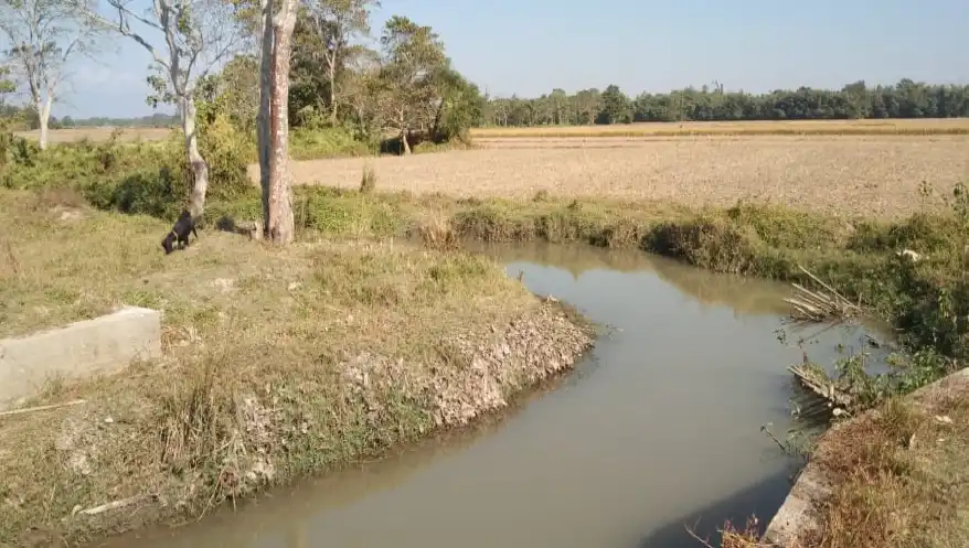
Physical characteristics of the Dong system:
A Dong can have a breadth of 7–15 feet on average or more, widening gradually from source to end. Most Dongs dry naturally at the end of their course or meet larger water bodies like rivers or beels. The longest Dong is reported at least 10 km, though most range between 2 and 5 km.
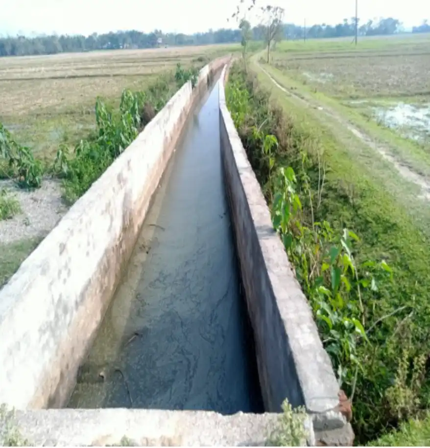
Dongs are macro water?carrying canals sourced from natural water bodies. Jamphai are smaller canals, 2–5 feet wide or more, that channel water from the Dong to fields. Dong and Jamphai are inseparable parts of the same system. Jamphai run along embankments on paddy fields – called Ali in contemporary Bodo and Assamese – built to retain water for cultivation. Sometimes a sublet is routed from a Dong to supply other clusters of villages.
Cost effective and sustainable
Compared to government?supported alternatives such as Shallow Tube Wells, Deep Tube Wells, low?lift irrigation, the Dong system is cost?effective for individual farmers and at the community level. Community involvement, collective labour, and low?investment design have sustained it as a low?cost, high?efficiency system.
The Dong system is also based on sustainable use of available natural water resources. Its successful operation across Bodoland for generations – without degrading the resource base or harming the interests of other groups – demonstrates its sustainability.
Challenges related with Dong system:
The traditional Dong irrigation system, however, faces several challenges: reduced river volumes, siltation, infrastructure neglect, and pressures from climate change and cross?border water sharing.
- Erratic monsoons, prolonged dry spells, and sudden heavy rainfall create fluctuating flows. Dongs often run dry during the critical winter cultivation season.
- Extensive upstream deforestation (in Assam and across the border in Bhutan) linked to development has caused severe soil erosion and deposition of sand and boulders at intake points, obstructing flow and reducing efficiency
- Many Dongs and canals remain outdated or fragile (non?concretized earthen channels and wooden embankments easily damaged by floods)
- While Dongs are crucial in the dry season, frequent and intense monsoon floods damage canals and related infrastructure, demanding constant repair and limiting operational periods.
Role of Soil Conservation Department
Recent interventions have strengthened flow?control mechanisms along Dongs. A major development is concrete sluice gates at key junctures to maintain desired water levels and prevent inundation of fields, a recurrent problem in many places.
Concrete overflow structures (check dams) have replaced bamboo and earth versions. Overflows hold water in the Dong at a fixed level—above the cultivating plots—so flow is maintained at the required quantity and speed. Excess water spills to another Dong while the working level is kept steady and routed via Jamphai to fields.
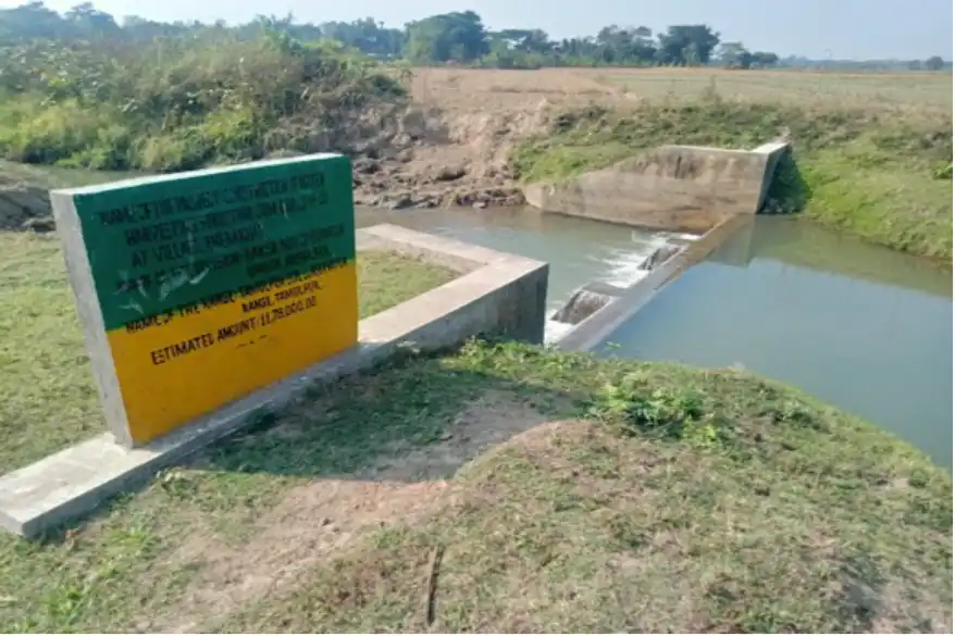
These concrete overflows and sluice gates have reduced damage from intense monsoon flows that once broke embankments and inundated cultivable land.
The Soil Conservation Department in BTC, Assam, has been instrumental in keeping Dongs efficient and in lessening flood hazards. Several concrete sluice gates and check dams in major Dongs in Kokrajhar were built around 50 years ago with government funds. Embankment reinforcement with boulders at vulnerable points has been carried out through government grants.
Traditionally, earth embankments gave way under rapid flows. To protect banks in different BTC districts, brick and/or concrete linings are being installed at vulnerable stretches. These revival projects not only restore water flow; they also empower communities by reactivating traditional water committees to manage the systems themselves.
Future implications
The Dong system shows that with strong, people?centric institutions and processes, water and livelihood security can be ensured for vast numbers of farmers who often live in the most disadvantageous areas and are left out of mainstream benefits. Dongs operate from the Bhutan foothills to the Brahmaputra plains and across different communities. This system honours everyone’s right to shared village water resources.
The equity inherent in the Dong system signals the appropriate social positioning of a sustainable resource?mobilization technology and management process. The challenge ahead is to carry forward the spirit of equity and participation as more efficient designs are created – independently or in assimilation with existing Dongs. Careful investigation is needed on replicability elsewhere.

Monidip Chutia, M.Sc. (Agri) & M.Tech. (RS & GIS), is Additional Director of Soil Conservation, BTC, Assam