
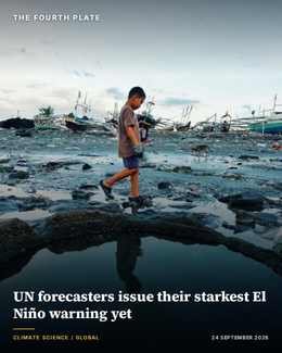
The World Meteorological Organization said on 3 September that the current El Niño is on track to become “very strong,” with nearly full certainty that the weather pattern will persist through February 2027. The agency described it as the first time in its 76-year history that it has issued such an unequivocal El Niño forecast this far in advance of the event’s peak.
Ocean temperatures in the Niño 3.4 region, the benchmark zone meteorologists use to track the pattern, ran 1.5°C above normal between May and July, climbing to 2.0°C by July and reaching weekly readings of 2.2°C to 2.6°C above average by mid-August. In some areas, subsurface ocean temperatures ran more than 8°C above average during July and early August, according to the El Niño forecast 2026 data WMO released alongside its warning.
UN Secretary-General António Guterres called the intensification unprecedented in blunt terms. “El Niño is being supersized before our eyes,” he said. “The planet is in uncharted waters, and those waters are heating up.” WMO Secretary-General Celeste Saulo echoed the urgency, saying “this exceptional El Niño demands exceptional preparation and response… we have no time to lose.”

Why September matters more than usual
El Niño events typically peak toward the end of the calendar year, and WMO expects this one to reach maximum intensity around the close of 2026, with its effects extending into 2027. For the September-to-November period immediately ahead, the agency forecasts above-normal temperatures across nearly all land areas, alongside the classic El Niño rainfall pattern of drought in some regions and flooding in others.
Two additional ocean signals are expected to interact with this El Niño rather than simply add to it. A positive Indian Ocean Dipole, measured at 0.9°C, and a warm equatorial Atlantic are both forecast to reinforce or, in some regions, alter the typical El Niño impact pattern, according to WMO’s regional analysis. That combination makes country-level forecasting harder even as the global signal grows clearer by the week.
The agency’s decision to name this event unprecedented rests partly on how early and how confidently it could make the call. Previous El Niño events have typically carried wider forecast uncertainty at this stage of the year, with meteorologists hedging between moderate and strong scenarios well into autumn. This year, WMO’s own scientists describe the underlying ocean signal as unambiguous enough to skip that hedging altogether, a change in tone that itself carries weight among the national weather services that rely on WMO’s global assessments.
The warning lands alongside mounting evidence that El Niño’s disruption is already reaching agricultural markets. A separate assessment this month found the pattern threatening harvests and planting schedules across Latin America for the 2026-27 season, while a September update to the world’s main hunger-tracking report cited El Niño’s expected persistence through early 2027 as a factor compounding food crises already under way in East Africa and the Middle East.
WMO has directed governments to its regional climate centres and national meteorological services for country-specific detail, rather than issuing blanket regional predictions from Geneva. That caution reflects a consistent pattern in El Niño science: the global signal, an exceptionally warm tropical Pacific, is now about as certain as such forecasts get, but its translation into rainfall or drought on any single farm still depends on regional and local factors a global forecast cannot fully capture.
For governments in food-insecure regions, the practical response is less about predicting exact rainfall totals than about pre-positioning resources: seed reserves, irrigation contingency plans and emergency food stocks that can absorb whichever version of El Niño’s disruption their region ends up experiencing, drought or flood, once the pattern peaks toward the end of the year.