

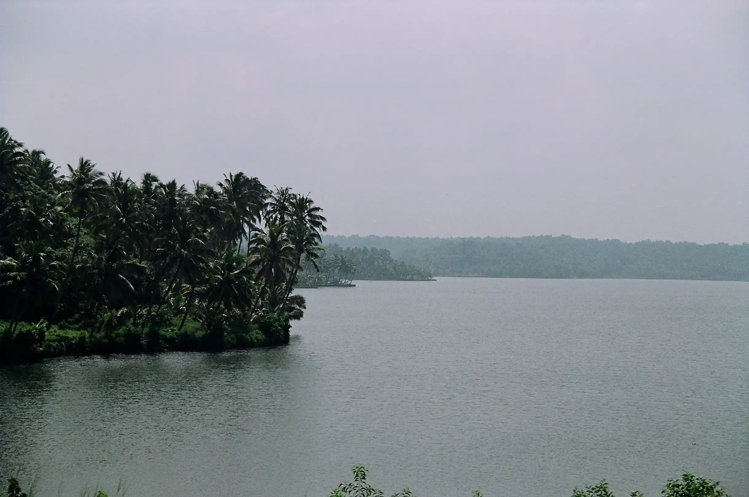
The tranquil hills of Chooralmala and Mundakkai in Wayanad, Kerala, underwent a violent transformation in the early hours of July 30, 2024. What had long been a landscape of serene greenery, mist-shrouded forests, and quiet villages became the stage for one of the most devastating landslides in recent Indian history.
Over the course of 48 hours, an extraordinary 572 millimetres of rainfall unleashed a cascade of destruction that claimed more than 400 lives, displaced nearly 10,000 people, and obliterated entire settlements, including Chooralmala, Mundakkai, and Vellarimala. The debris flow, which stretched nearly eight kilometres, reshaped the course of the Iruvazhinji River, annihilating over 1,500 homes, schools, and community structures. The disaster’s magnitude demonstrated not only the overwhelming power of nature but also the cumulative effects of human actions that had made these environments more vulnerable.
The Janakeeya Sasthra Samiti’s report, Sliding Earth, Scattered Lives, characterised the event as a “grey rhino” disaster—a threat that was both highly probable and largely neglected. Despite clear warnings from the Hume Centre for Ecology and Wildlife Biology about heightened landslide risk following heavy rains on July 28–29, 2024, preventive action was minimal, leaving communities exposed to catastrophic consequences. The Chooralmala-Mundakkai landslide thus emerged as a concrete example of how ecological sensitivity, human activity, and administrative oversight intersect in lethal ways.
Among the experts called to study the disaster was Dr C.P. Rajendran, a distinguished geoscientist and adjunct professor at the National Institute of Advanced Studies, Bengaluru. Renowned for his work in paleoseismology and seismotectonics, Rajendran brings a rare combination of scientific rigour and human empathy to his work.
In this interview, he reflects on the Chooralmala-Mundakkai landslides—not merely as an isolated tragedy, but as a cautionary signal for other vulnerable landscapes across India, from the Western Ghats to the Himalayan foothills. He discusses the factors that contributed to the disaster, the systemic failures that amplified its impact, and the broader implications for communities living on fragile slopes in a country increasingly defined by climatic extremes and developmental pressures.
Few voices in Indian geoscience carry the authority and urgency of Rajendran. Born in Ottapalam, Kerala, in 1955, he has spent over four decades attuned to the subtle tremors of the earth, tracing the footprints of ancient earthquakes and translating them into insights capable of saving lives.
From the tremors of Killari in Latur to the restless plate boundaries of the Andaman-Nicobar Islands, his research has been wide-ranging. Yet it is his connection to the lived realities of vulnerable communities—farmers, hill dwellers, and tribals—that sets him apart from many of his peers. When the Mundakkai tragedy struck, he was not merely analysing data; he was acting like a sentinel, interpreting warning signs that, if heeded, might prevent future disasters.
Rajendran’s approach to science is inseparable from ethics. While he collaborates internationally and publishes in leading journals, he ensures that his findings reach those most at risk. Whether scrutinising the seismic hazards of infrastructure projects such as the Char Dham roads or assessing environmental vulnerabilities in Kerala’s SilverLine, his interventions are rooted in evidence but framed by a profound concern for human welfare. The Mundakkai study exemplifies this ethos: it is not merely a technical report but a clarion call linking geological phenomena with social responsibility.
To sit down with C.P. Rajendran is to engage with more than a geologist. It is to converse with a custodian of the earth’s memory, a chronicler of hidden tremors, and a moral compass in a country where ambition often outruns caution. The landslides of Chooralmala and Mundakkai, he insists, are neither isolated nor unpredictable; they are part of a continuum of ecological warnings that India’s hills, valleys, and plateaus have been signalling for generations. His work compels us to read those signals, act decisively, and respect the fragile landscapes that sustain millions.
Over four decades, Rajendran has carved a distinctive niche in Indian geoscience: one that balances meticulous observation with ethical engagement. His scholarship spans paleoseismology, seismic hazard assessment, and environmental risk evaluation, yet it is never abstract.
From the tremors of Latur to the shifting sands of the Rann of Kachchh and the Andaman-Nicobar Islands, his analyses illuminate not only the forces that shape the earth but also the human communities that dwell atop it. Through his writing, public engagement, and field interventions, he bridges the often-daunting divide between scientific understanding and societal action, reminding us that knowledge of the earth is a responsibility, not a privilege.
This interview with C.P. Rajendran is more than a conversation with a geoscientist. It is a dialogue with a sentinel who listens to the earth’s whispers, deciphers its urgent warnings, and challenges us to confront the consequences of our choices. As India navigates the dual imperatives of development and environmental stewardship, his insights on the Chooralmala-Mundakkai landslide resonate far beyond Wayanad, offering lessons for every fragile landscape and every community at risk.

Excerpts from the interview with Dr. C.P. Rajendran:
Q: In your recent study report, you describe the Wayanad landslide as a “grey rhino”—a disaster that was clearly visible and predictable, yet ignored until it struck with deadly force. Could you explain why you chose that metaphor and what it tells us about the way Kerala and India treat warnings from science?
A: The report, prepared by an expert group initiated by Transition Studies and the Western Ghats Conservation Committee, analyses the Mundakkai-Chooralmala landslide, which claimed hundreds of lives in 2024. Our conclusion is stark: this was largely a man-made disaster. The significant loss of life was not solely due to natural disasters; it was a result of disregarding warnings and lacking adequate preparation.
The metaphor of the “Grey Rhino”, coined by Michele Wucker, describes threats that are highly probable yet systematically overlooked. In our study, it was a deliberate choice to emphasise that authorities failed to act despite repeated signals. Landslide vulnerability had been building for years in the region—small slips, old landslide scars, changes in land use, and high-intensity rainfall all pointed toward a major disaster. But these warnings were ignored.
Satellite imagery from the National Remote Sensing Centre confirms our findings. It shows the lobe of an old landslide, indicating that the headwater region had experienced similar events in the past.
The 2024 disaster occurred just 2-3 kilometres from Puthumala, the site of a 2019 landslide that killed 17 people. That earlier event began as a minor slip deep in the forest but gained momentum as it reached lower, water-saturated slopes. It eventually became a destructive flow of rocks and mud, reshaping the hillside. The Mundakkai landslide unfolded in a comparable manner. The extreme rainfall acted as a trigger, but the scale of destruction was amplified because prior warnings were ignored and vulnerabilities were left unmitigated.
Investigators from the Hume Centre for Ecology and Wildlife Biology in Kalpetta had recorded 572 mm of rainfall at a rain gauge in Puthumala—more than during the 2019 event—and warned the district authorities sixteen hours before the landslide. Unfortunately, this warning was not acted upon. Our report emphasises that such early signals could have enabled preventive, evacuation, and mitigation strategies. It is a strong indication that authorities must conduct regular “grey rhino” assessments in landslide-prone regions, using scientific methods that can be applied across the Western Ghats, where terrain and climate are comparable.

Q: Looking closely at Chooralmala and Mundakkai, what were the most direct triggers of the landslides? Beyond the heavy rainfall, how did human interventions such as road cutting, quarrying, poorly planned construction, and altered slopes from plantations exacerbate the vulnerability?
A: Wayanad’s landscape has undergone profound transformations over the decades. Plantations of tea, coffee, cardamom, pepper, and rubber have largely replaced the dense forests. These shifts in land use have critically weakened the district’s natural resilience to landslides. Clearing forested areas for monocrop plantations alters soil composition, reduces natural root networks, and disrupts hydrological patterns.
Deforestation and changes to natural vegetation for farmland are among the most significant anthropogenic factors. These activities began during British rule and, over more than two centuries, have transformed soil structure and groundwater flow across Wayanad. When large trees were removed, their roots remained underground, gradually decaying to create cavities that act as conduits for rapid subterranean water flow. This process, combined with the absence of soil protection measures such as stubble mulching—which local farmers rarely practice—has increased hydraulic conductivity and accelerated subsurface erosion, making slopes vulnerable to piping and collapse.
New plantations further disturbed soil stability. Tilling, loosening topsoil, and irrigation arrangements increased susceptibility to landslides. When heavy rainfall occurs, water rapidly infiltrates the soil, causing erosion, piping, and rotational slope movements. Mundakkai itself had a prior landslide in 1984, which claimed 14 lives. This data shows that the area has long been fragile, but historical lessons were never fully applied to prevent future disasters.

Q: Wayanad’s rainfall patterns are changing, with shorter, more intense bursts of rain becoming the norm. According to your research, how exactly is climate change amplifying the risks here, and what does this tell us about the future of other hill districts in Kerala?
A: The intensification of short-duration heavy rainfall, coupled with higher atmospheric moisture, is now the dominant trigger for landslides in Kerala. These extreme events interact with soil and slope characteristics—including shear strength, grain interlocking, and pore-water pressure—to determine slope stability. Human activity compounds these natural vulnerabilities. Construction, agriculture, and land-use changes degrade drainage and soil integrity, making slopes more susceptible to failure.
The question arises: why do minor landslips at the top evolve into massive mass wasting further down the slope? One reason is the long-term deterioration of soil water-carrying capacity, driven by anthropogenic changes. In 1984, the Mundakkai landslide did not escalate to a massive disaster because soil integrity was relatively better.
However, today, unregulated human interventions and intensified rainfall are pushing ecologically fragile regions like Wayanad to a critical point. Unless we take urgent, preventive action, every extreme rain event now carries the risk of triggering another catastrophe.

Q: Tourism is celebrated as Wayanad’s economic engine, yet hotels, homestays, and adventure parks are proliferating on fragile slopes. How do you assess the role of unregulated tourism in destabilising these terrains?
A: Human-induced habitat fragmentation, including construction for tourism, has led to deforestation, slope instability, and disrupted wildlife movement. Animals are forced into human settlements, while tribal livelihoods are jeopardised. While tourism provides revenue, the terrain’s ecological carrying capacity must guide development. Inadequate waste management and rising footfall further aggravate environmental stress.
Unplanned roads, hilltop resorts, and adventure tourism infrastructure alter natural drainage patterns, concentrate runoff, and often necessitate blasting or cutting into slopes, thereby weakening the structural integrity of the hill. What many developers overlook is that even moderate intervention can compound instability in an already fragile terrain.
Wayanad’s hills are not just soil and rock; they are living systems, and overstepping the ecological carrying capacity invites disasters that are preventable but often ignored.
Q: The proposed tunnel road is presented as a lifeline for connectivity and development. From a geological and disaster-management perspective, do such mega projects carry more risks than benefits in a district already prone to landslides?
A: The tunnel passes through ecologically sensitive areas, terminating at Kalladi, part of the Nilgiris-Wayanad-Coorg biodiversity corridor. This corridor encompasses the sites of two major landslides in six years. Tunnels and blasting activities risk further destabilising slopes. Moreover, the project could disrupt elephant migration routes, increasing human-wildlife conflict and threatening both ecological and human safety.
Beyond the immediate geological risks, such projects often fail to account for cumulative impacts—the compounding effect of multiple road cuts, drainage interference, soil loosening, and slope alteration across decades. Risk assessments sometimes rely on static or short-term studies, but in a place like Wayanad, even small interventions can trigger catastrophic slope failures under intense rainfall. Infrastructure design must incorporate long-term slope stability, hydrological patterns, and ecological continuity, yet development narratives rarely prioritise these considerations.
Q: The displaced survivors of the Wayanad landslide, particularly Adivasi families, often say rehabilitation uproots them not just from land but from culture, tradition, and livelihoods. How do you evaluate the state’s recovery measures so far?
A: The state’s response has been largely inadequate. Basic financial and housing assistance was provided, but mass relocation has left Adivasi communities feeling disconnected from their ancestral lands, culture, and livelihoods. Compensation must go beyond housing, including restoration of agricultural lands and subsistence farming support.
Without addressing these deeper social and cultural wounds, relocation risks perpetuating trauma and vulnerability. Recovery plans often focus on short-term relief: temporary shelters, monetary assistance, and quick rebuilding, without integrating long-term cultural and economic continuity. Adivasi communities are deeply tied to their lands—not just physically, but spiritually and economically.
Displacing them without restoring access to traditional farming lands, forest resources, and community networks disrupts the social fabric and increases the risk of chronic vulnerability, where people remain exposed to the very disasters that have displaced them.
Q: Wayanad depends heavily on cash crops like coffee, pepper, and ginger, yet climate volatility, landslides, and soil erosion threaten their viability. Does the district need a fundamental rethinking of its agricultural model to adapt to the changing environment?
A: Indeed. Monocrop plantations have left the district’s farmers highly vulnerable to ecological and economic shocks. Forest conversion for cash crops has degraded biodiversity and soil health while increasing susceptibility to landslides and soil erosion.
We urgently need sustainable, diversified agricultural practices to restore resilience and ensure livelihoods. Crop rotation, polyculture, intercropping with soil-conserving plants, and organic mulching can reduce soil erosion, enhance water retention, and increase ecological resilience.
Farmers must be supported with both knowledge and resources to transition away from high-risk monoculture, which offers short-term profits but long-term instability. Integrating traditional ecological knowledge of hill communities with modern agronomy can provide a pathway toward productive, safe, and ecologically sustainable farming in Wayanad.

Q: Human–animal conflict is intensifying as forests fragment and wildlife is pushed into farmlands. How does this add to the distress of already fragile farming communities, and what does it signal about our approach to conservation?
A: Fragmented reserves and disconnected corridors are no longer adequate. Elephants and other wildlife, particularly male elephants, enter agricultural areas seeking food. Sustainable solutions require landscape-level planning to restore ecological corridors, link habitats, and enable safe wildlife movement.
Conservation must actively involve local and Indigenous communities, integrating traditional ecological knowledge and empowering them to co-manage landscapes. This approach builds trust, fosters coexistence, and moves beyond ineffective, temporary mitigation measures. Simply erecting fences or resorting to culling is short-term thinking.
To coexist safely with wildlife, communities require support, and we must restore ecological continuity at the landscape level. The Wayanad experience demonstrates that fragmented conservation is insufficient; long-term planning, community participation, and habitat connectivity are essential to prevent both human and animal suffering.
Q: Suppose Wayanad has to survive as a viable home for people, wildlife, and agriculture. What fundamental changes must be made in land-use planning, tourism policies, infrastructure design, and disaster preparedness?
A: Construction, primarily for tourism, continues, often unregulated. Built-up areas in Vythiri Taluk increased by 19 per cent (115 sq. km) between 2015 and 2021. Quarrying depletes topsoil and vegetation, while explosives and machinery widen fractures, destabilising slopes. Reducing landslide frequency requires scientific land-use practices, respecting terrain carrying capacity, managing natural drainage, and collecting historical and geological data. Disaster preparedness must be proactive rather than reactive. Local communities need early-warning systems, evacuation plans, and training to respond efficiently to imminent threats.
Urban planning and tourism regulation should be grounded in geological, hydrological, and ecological science. Infrastructure designs—roads, bridges, and tunnels—must integrate slope stability models, drainage optimisation, and long-term monitoring. Importantly, any development must align with the carrying capacity of fragile hill ecosystems. Failure to integrate these considerations guarantees repeated tragedies.

Q: Do you see Wayanad as a microcosm of a larger crisis unfolding across India’s hill districts—and if so, what lessons must policymakers in other states learn before the next “grey rhino” strikes?
A: Current landslide susceptibility maps are broad and static, lacking detail on specific initiation points or probable flow paths. High-resolution, dynamic mapping must inform residents of real-time risk. Technologies like InSAR (Interferometric Synthetic Aperture Radar) can track both rapid and slow ground deformations. Integrating MT-InSAR data with machine learning allows for dynamic, predictive landslide susceptibility maps, incorporating slope, aspect, stream proximity, precipitation, vegetation, soil type, and geology.
Policymakers must ensure that early warning systems are not only developed but also effectively communicated and operationalised at the community level. Communities themselves must be empowered to monitor, interpret, and act on data. Technology is only as effective as the human systems it serves.
Q: Community participation is often cited as key in disaster management. Can you give examples of how local involvement can save lives?
A: Near Mundakkai, community participation in early-warning efforts exemplifies how local knowledge and collective action can save lives. Villagers, trained to observe soil saturation, minor slips, and water flow changes, provided real-time information that supplemented official rainfall and satellite data. Such grassroots involvement ensures timely evacuation, reduces fatalities, and builds resilience. Local communities understand their terrain in ways that external agencies often cannot. Combining this local expertise with scientific monitoring creates a robust, multi-layered disaster management framework. Empowering residents in monitoring, preparedness, and mitigation ensures resilient systems that move beyond reactive, short-term responses.
Q: If you had to summarise the lessons from the Wayanad disaster for India’s hill districts, what would they be?
A: Wayanad’s tragedy is a warning for all of India’s hill districts. Without integrating science, local knowledge, and responsible land management, every “grey rhino” remains a ticking time bomb.
Early warnings must be heeded; land-use policies must respect ecological carrying capacity; infrastructure must be designed for slope stability; community participation must be central; and conservation must be approached with landscape-level vision.
Every rainfall event, every small slip, and every alteration to the natural terrain is a signal. Ignoring these signals is no longer acceptable. India must act proactively to protect lives, livelihoods, and ecological integrity in its fragile hill regions.

K.A. Shaji is an independent journalist from South India, known for his in-depth reporting on rural distress, caste, tribal affairs, environment, and development. Over the past two decades, he has worked with leading publications including The Hindu, The Times of India, The Indian Express, The Hindustan Times, The Telegraph, Dainik Bhaskar, Tehelka, HuffPost India, Open, Outlook, and South First, while also contributing to international outlets such as The Guardian, BBC, Financial Times, and Mongabay. Based in Kerala, he continues to chronicle stories from the ground that connect local struggles with national and global debates on justice, ecology, and governance.
Email: shajiwayanad@gmail.com
Tel: 00 91 8921018884
Follow on: LinkedIn


Leave a Reply to Jayant Padmakar MahajanCancel reply